
A parking consultant with a clipboard surveys 250 spaces per hour. A drone with AI covers 6,000 in the same time, and never miscounts a row.
Parking and traffic surveys have relied on manual methods for decades: interns counting cars with tally sheets, pneumatic tubes across roads, induction loops buried in pavement. These tools are slow, expensive to maintain, and produce data that is outdated before the report is finished. Drone-based AI counting replaces clipboard studies with aerial photos that deliver stall-by-stall accuracy in a fraction of the time.
The clipboard problem
Traditional parking surveys typically involve field workers walking rows of parked cars, recording occupancy on paper or tablets. According to DataTerminal's 2025 survey guide, manual methods achieve 80 to 85% accuracy. Surveyors lose count in large lots, skip rows by mistake, and struggle to capture turnover data because they can only be in one place at a time.
Pneumatic tubes and induction loops offer automation, but they count vehicles at fixed points, not across entire lots. They cannot tell you which spaces are occupied, how long each vehicle has been parked, or whether the far corner of a 3,000-space lot is at capacity. The result is that most parking studies happen once or twice a year, producing static snapshots of a dynamic system.
How aerial vehicle counting works
The workflow is straightforward: fly, capture, detect, report.
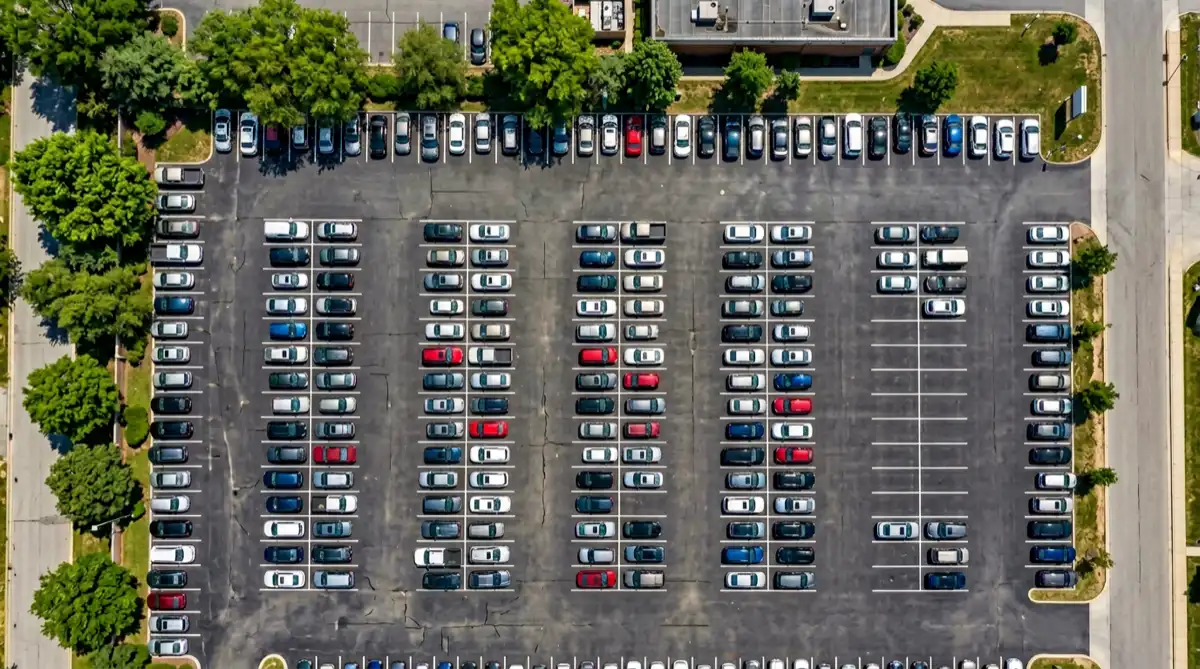
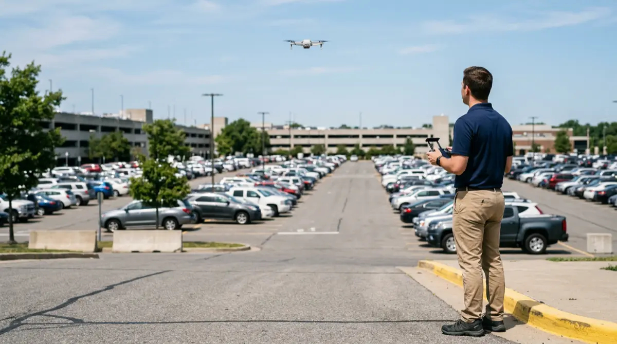
A drone operator launches a consumer UAV - a DJI Mini 3 or similar model - and flies a grid pattern over the target area at 30 to 60 meters altitude. The drone captures high-resolution photos at regular intervals, covering every row and corner of the lot.
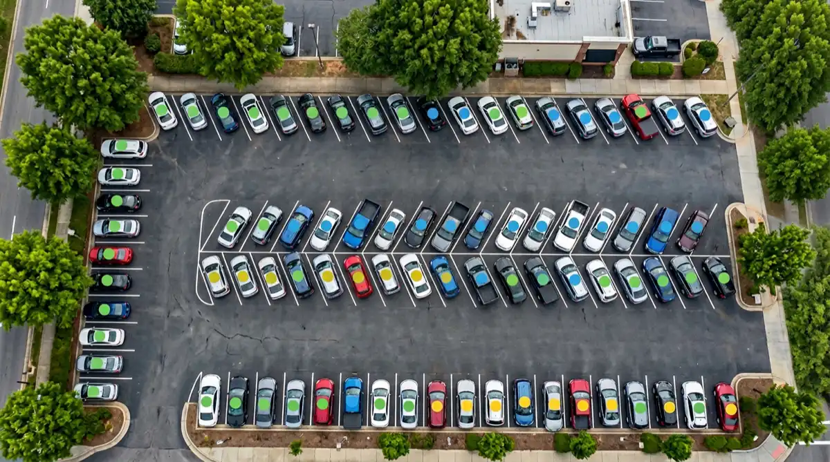
The images are processed by an AI detection model, typically based on the YOLO architecture. A 2026 MDPI study used YOLOv11 on DJI Mini 3 imagery and achieved strong precision and recall while maintaining frame rates suitable for real-time deployment. The model detects vehicles, marks each one, and outputs a total count with a visual map of the lot.
Parkalytics, a drone-based parking analytics company, reports that a single operator surveys up to 6,000 spaces per hour - 23 times faster than a clipboard study. Their machine learning pipeline turns raw footage into stall-by-stall occupancy, duration estimates, and turnover analysis.
Accuracy: what the numbers say
AI vehicle counting from aerial images consistently outperforms manual methods. Automated systems achieve 95 to 99% accuracy, compared to 80 to 85% for clipboard surveys. The gap widens in large, complex lots where human surveyors lose track of rows or miss vehicles in shadowed areas.
The CARPK benchmark dataset contains nearly 90,000 annotated vehicles across four parking lots photographed by drones at approximately 40 meters altitude. Recent YOLO variants reach 92.4% mean Average Precision on traffic datasets, and YOLOv8 paired with ByteTrack tracking achieves up to 97.6% counting accuracy at over 20 frames per second.
Automated AI-powered parking surveys cut data collection time by 90% compared to manual methods while improving accuracy from the 80-85% range to 95-99%. Facilities using regular occupancy monitoring increase operational efficiency by 35% on average.
Beyond counting: classification and turnover
Counting vehicles is only the starting point. The same AI models that detect cars can classify them by type and track how the lot changes over time.
AI distinguishes cars, trucks, motorcycles, and buses from aerial images. This data helps planners allocate oversized spaces, motorcycle zones, and loading areas based on actual usage.
By comparing snapshots taken at intervals, AI calculates how long each vehicle stays. This reveals whether a lot serves short-term shoppers or all-day commuters.
Turnover rate - how many times each space changes hands per day - is critical for retail parking and downtown meters. Drones capture this data passively across the entire lot.
Repeated surveys build time-series data that reveals peak hours, seasonal patterns, and the true capacity utilization of underused lots.
Use cases: from city halls to airports
In Breckenridge, Colorado, Parkalytics surveyed 3,000 parking spaces across the town using drone flights over two days. The resulting stall-by-stall data informed the town's parking strategy with a level of detail that would have taken weeks of clipboard work.
Municipal planning is the most common application, but the use cases extend further. Airport operators monitor long-term and short-term lots to optimize shuttle routes. Retail developers correlate parking occupancy with foot-traffic data. Event venues use pre- and post-event aerial counts to validate attendance. Transportation agencies survey corridors where traditional counters are impractical.
The privacy advantage
One of the strongest arguments for drone-based surveys is what they do not capture. At 30 to 60 meters altitude, photos show vehicle shapes and positions but cannot resolve license plates or faces. Parkalytics confirms their surveys collect zero identifiable data, sidestepping the legal complications of ground-level surveillance cameras, ALPR systems, and Bluetooth tracking.
For municipalities concerned about public perception, this matters. Drone surveys count vehicles without monitoring people.
The bigger picture: smart city data
The smart parking market is projected to grow from $8.5 billion in 2023 to over $35 billion by 2028. AI vehicle counting is a core enabling technology. Research on AIoT-based traffic management shows that adaptive AI signal control outperforms traditional static traffic lights by 34%, reducing congestion at busy intersections. Drone surveys generate the ground-truth occupancy data that feeds wayfinding apps, dashboards, and congestion models.
The bottom line
Parking and traffic surveys do not need to be slow, expensive, or inaccurate. A consumer drone, a trained AI model, and one operator can survey thousands of spaces in under an hour with better accuracy than any clipboard study.
The next time you need to know how full a lot is, how long cars stay, or which spaces never get used, send a drone up. The data will be on your screen before the old-school surveyor finishes their first row.