
A human observer in a moving aircraft misses roughly 1 in 10 elephants. The algorithm does not get tired.
Wildlife population surveys are the backbone of conservation. Every management decision, from anti-poaching patrol routes to habitat protection budgets, depends on knowing how many animals are out there. For decades, the standard method has been the same: fly low over the landscape and count what you see. The problem is that human eyes in a moving aircraft are not very good at this job.
The traditional aerial survey and its limits
A conventional wildlife survey works like this: trained observers lean out of a low-flying aircraft (typically 60 to 100 meters above ground) and count animals within a defined strip on either side. They tally species, group sizes, and locations on paper or with a voice recorder, often for 6 to 8 hours at a stretch.
The problems are well documented. Observer fatigue sets in after the first hour, and accuracy drops steadily. Different observers counting the same transect routinely produce counts that differ by 10 to 30%. Animals in shade, behind bushes, or in dappled woodland are frequently missed. Weather, turbulence, and altitude all introduce additional variability. And the flights themselves are expensive and dangerous: low-altitude survey flying is one of the highest-risk activities in conservation.
How AI changes the count
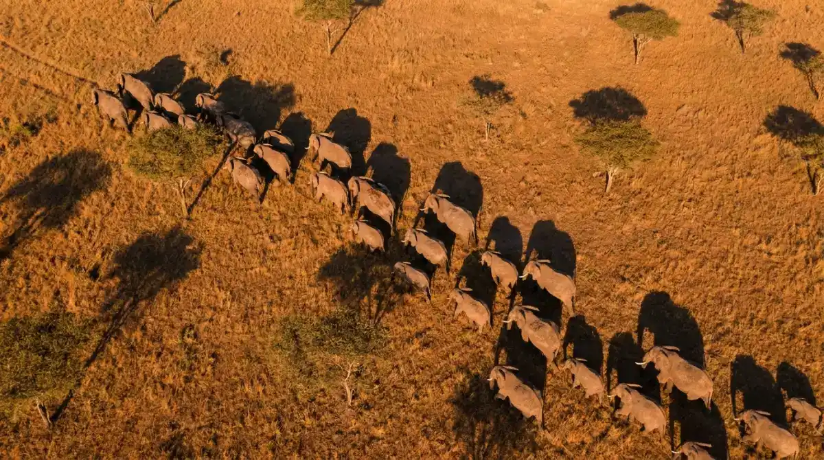
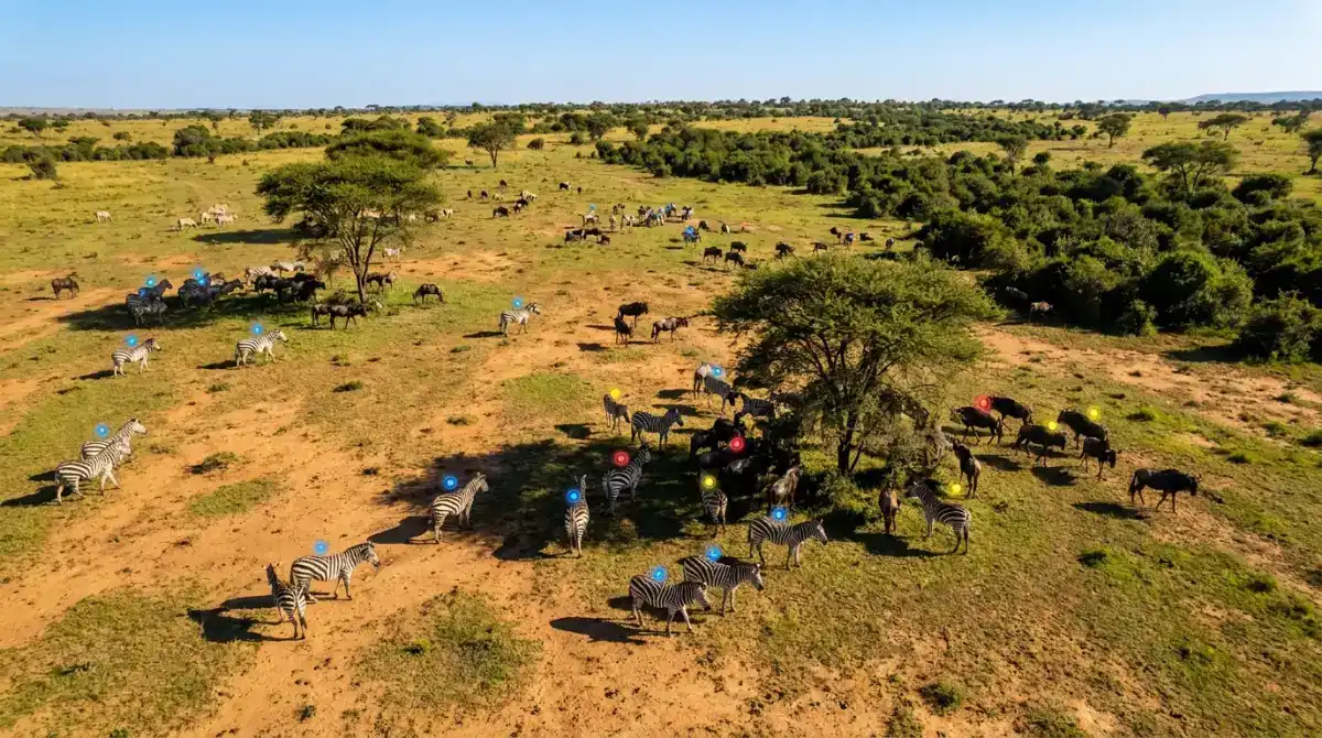
AI-assisted aerial surveys flip the workflow. Instead of relying on human observers to spot and count animals in real time, the aircraft (or drone) captures high-resolution photographs of the entire survey area. Back on the ground, a detection model scans every image and marks each animal it finds.
The detection model, typically a convolutional neural network like RetinaNet, processes images in a single pass. It identifies animals by shape, size, and contrast against the background, then places a marker on each detection with a confidence score. A human reviewer checks flagged images and edge cases, but the bulk counting is handled automatically.
Research published in Wageningen University's animal population studies found that RetinaNet detected 95% of elephants, 91% of giraffes, and 90% of zebras compared to expert human annotation, while correctly identifying an additional 2.8 to 4.0% of animals that human annotators missed entirely. The model produced only 1.6 to 5.0 false positives per true positive.
A Frontiers in Conservation Science study found that AI-assisted methods can reduce population estimate standard error by 31 to 67% compared to manual methods, with potential for sampling effort increases of 160 to 1,050% at equivalent cost. That means more area surveyed, more often, for the same budget.
Which species work best
Not every species is equally easy for AI to count from the air. The best results come from animals that are large, distinctly colored, and found in open habitats.
Elephants, cattle, zebras, and wildebeest are ideal candidates. Their size makes them easy to detect, and open savanna provides strong contrast.
Flamingos, penguins, and seabird colonies sit in dense, visible groups on open ground. AI excels at counting thousands of individuals in a single image.
Seals, sea lions, and walruses hauled out on coastline are clearly visible from above. Thermal imaging adds a second detection channel.
Ranchers and wildlife managers use identical techniques for cattle, horses, and reindeer in open rangeland.
The auditability advantage
One of the most underappreciated benefits of photo-based surveys is permanence. A traditional observer count is a number on a clipboard. It cannot be rechecked, challenged, or improved after the flight.
A photograph is permanent evidence. Every image captured during an AI survey can be archived, re-examined by different reviewers, and re-processed years later with improved algorithms. If a new model is 5% more accurate than last year's, you can rerun it on last year's images and get a better historical estimate without flying again.
This creates a growing dataset that improves over time. Conservation organizations like Wild Me have built open-source platforms (such as Scout) that allow researchers worldwide to contribute and re-analyze aerial imagery. The photo itself becomes the scientific record, not the count derived from it.
Where AI counting still struggles
AI aerial counting is powerful but not universal. Several conditions remain genuinely difficult.
- Dense vegetation - Animals under thick tree canopy are invisible to standard cameras. Forest elephants and primates remain hard to survey from the air.
- Nocturnal species - Creatures active only at night require thermal or infrared imaging, which has lower spatial resolution than daytime RGB cameras.
- Aquatic animals below the surface - Marine species underwater, such as dolphins or fish, cannot be reliably detected from aerial photographs.
- Small or camouflaged species - Animals that blend into their surroundings, like hares on dry grass, push detection models to their limits.
- Extreme weather - Cloud cover, rain, and strong winds degrade image quality and can ground drone and aircraft operations entirely.
Getting started with AI wildlife counting
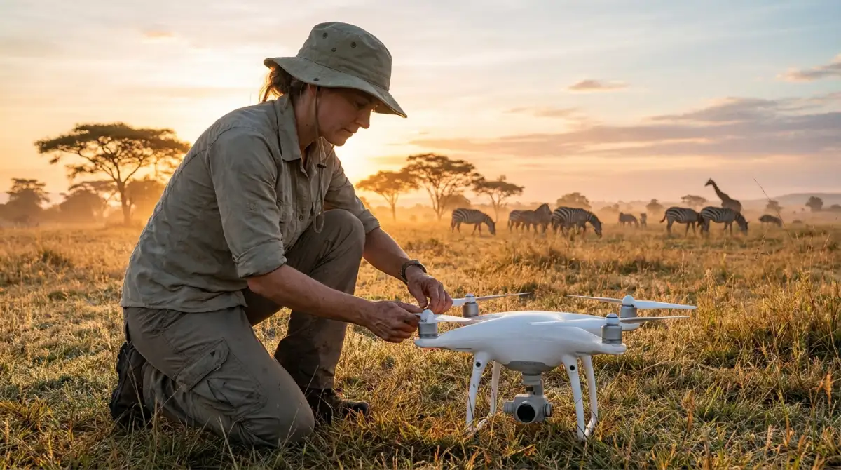
- Choose your platform- A consumer drone (DJI Mavic or similar) works for small areas; manned aircraft or fixed-wing drones cover larger reserves.
- Plan your flight grid- Use automated waypoint navigation to ensure consistent altitude and full area coverage with image overlap.
- Capture at the right time- Early morning or late afternoon light reduces harsh shadows. Avoid midday when animals seek shade.
- Process with a detection model- Upload images to an AI counting platform. Open-source options include Wild Me's Scout for wildlife-specific detection.
- Review flagged detections- Check low-confidence markers and edge cases manually. This hybrid approach maximizes accuracy.
- Archive everything- Store original images alongside count data. Future algorithms will extract even more value from today's photos.
The bottom line
Wildlife conservation depends on accurate population data, and for decades the best tool available was a tired observer in a noisy aircraft. AI-powered aerial counting does not replace human expertise in conservation, but it removes the bottleneck of manual counting from the equation.
The next time a reserve needs a population estimate, the most accurate answer will come from a camera, not a clipboard. And unlike the clipboard, the photos will still be useful a decade from now.