
A nursery with 50,000 trees used to spend three days counting them. Teams walked rows with clipboards, lost their place in the afternoon heat, and started over. Now it takes one drone flight and an AI model that maps every tree from above.
Tree and plant counting is one of the most time-consuming tasks in nurseries, orchards, and reforestation projects. Insurance companies want exact numbers. Buyers need shipment quantities confirmed. Managers need to know what survived the winter. Manual counting at this scale is slow, inconsistent, and expensive. AI-powered aerial counting offers a faster path to the same answers.
Why accurate tree counts matter
Tree counting is not just inventory management. It drives real financial decisions.
Nurseries sell trees by exact count. An order for 10,000 saplings needs to be fulfilled precisely, and the nursery needs to know if it has 10,000 or 9,400 before making promises. Insurance claims after storms or disease require documented counts to prove losses. Orchard managers estimate yield based on tree counts, and a 5% error in tree count translates directly into a 5% error in harvest planning.
For reforestation projects, counting planted trees verifies compliance with environmental regulations and carbon credit commitments. These counts often need to cover hundreds of hectares of uneven terrain where walking every row is impractical.
How aerial AI counting works
The process has three steps: fly, capture, and count.
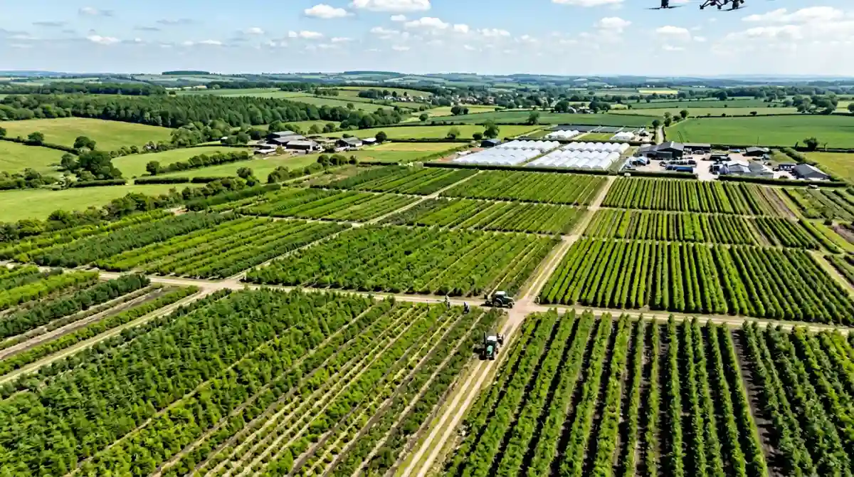
A drone equipped with an RGB camera flies a grid pattern over the target area at 30 to 80 meters altitude, depending on tree size and density. The flight captures overlapping images that cover every section of the field. For a 10-hectare nursery, the flight takes 15 to 30 minutes.
The images are uploaded to an AI model trained on aerial tree detection. The model scans each image, identifies individual tree canopies or trunks, and marks them with detection points. Overlapping images are stitched together so each tree is counted once, not duplicated across frames.
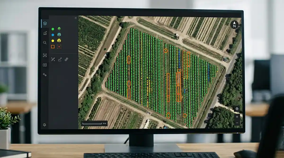
The output is a total count plus a georeferenced map showing the exact location of every detected tree. Nursery managers can zoom in, verify detections, and spot gaps where trees are missing or dead.
Accuracy benchmarks
Accuracy depends on canopy density, image resolution, and tree spacing. The numbers from recent studies are encouraging.
93 to 95% accuracy in dense canopy conditions. Reduces manual effort by over 70% and processes imagery nearly 5 times faster than traditional methods.
An on-the-fly UAS counting system achieved an F1 score of 99.09%, correctly identifying trees during flight with results available seconds after takeoff.
95% accuracy for tree trunk detection and a mean average precision of 0.977, with a 515% speed improvement over manual methods.
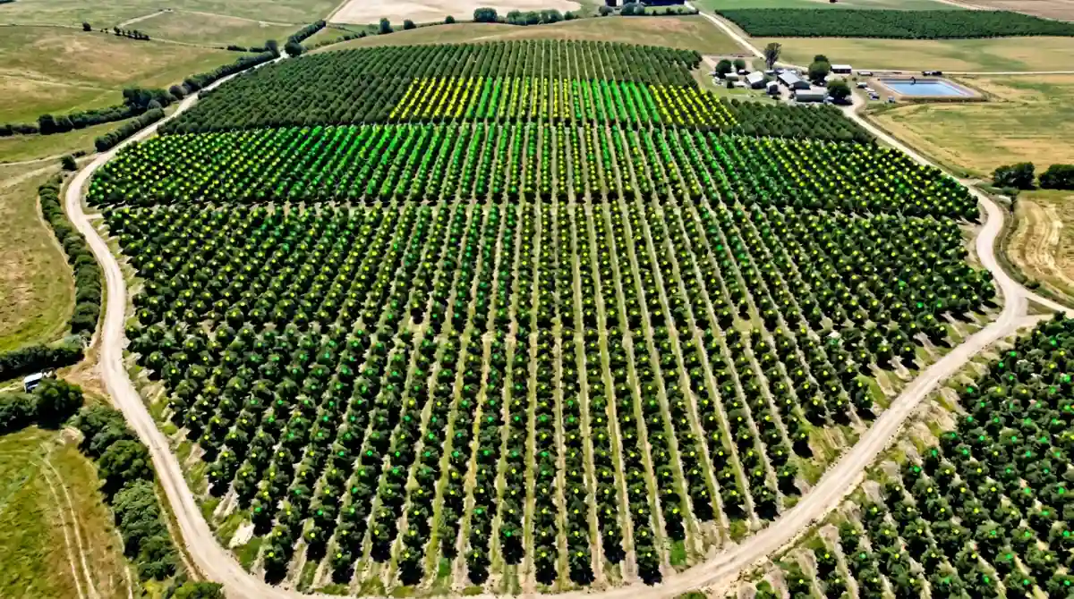
The pattern is consistent: well-spaced trees in uniform rows yield 95%+ accuracy. Dense, overlapping canopies reduce accuracy to the low 90s because the model struggles to separate individual crowns that merge visually from above.
Best practices for aerial tree photos
- Fly at 40 to 60 meters altitude for the best balance of coverage and resolution
- Use 70 to 80% image overlap to ensure complete coverage and accurate stitching
- Fly in midday or overcast conditions to minimize shadows that confuse canopy detection
- Avoid windy days when branches sway and blur images
- For dense canopies, fly lower to increase resolution per tree
- Capture images at consistent altitude to keep scale uniform across the dataset
Beyond counting: what else aerial AI reveals
Tree counting from drone images produces a useful side effect: a map of gaps. Missing trees, dead trees, and areas with poor growth show up as holes in the detection pattern. Nursery managers use these gap maps to plan replanting, schedule irrigation adjustments, and identify pest or disease outbreaks before they spread.
Some systems combine counting with health classification, using multispectral imagery to flag trees showing signs of stress. A single drone flight can deliver an inventory count, a health assessment, and a gap analysis, three tasks that would take separate manual efforts on the ground.
Limitations to know
- Dense, overlapping canopies reduce accuracy because individual trees merge visually from above. Deciduous species in full leaf are harder to separate than bare-branched winter trees.
- Very young seedlings under 30 centimeters may be too small to detect reliably from standard drone altitude. Lower flights help but reduce coverage.
- Mixed species plantings where different tree sizes overlap can confuse models trained on uniform rows.
- Regulatory restrictions on drone flights near airports, urban areas, or protected airspace may limit where you can fly.
The bottom line
Drone-based AI tree counting turns a multi-day manual job into a single flight. The accuracy is high enough for insurance claims, sales orders, and regulatory compliance, and improving with every new model generation.
If your operation counts trees by walking rows with a clipboard, try flying a drone over the same area. The count will be on your screen before the drone lands, and the map will show you things no ground-level walk ever could.